
What Should You Know Before Buying a Lake Lanier Waterfront Home?
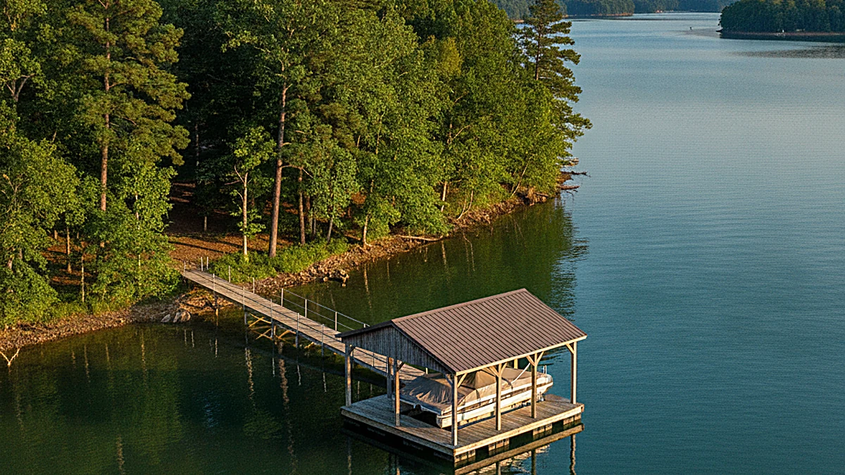
What Should You Know Before Buying a Lake Lanier Waterfront Home?
TL;DR, the quick answer
On Lake Lanier the land under and around the water belongs to the federal government, not the homeowner. A dock sits on public property under a Shoreline Use Permit that the Army Corps of Engineers issues for a maximum of five years and that is nontransferable, so it does not convey with the house. Verifying that permit is the single most important step in a waterfront purchase.
The lake elevations and permit rules below are quoted from the U.S. Army Corps of Engineers Mobile District, which administers Lake Sidney Lanier, and each is linked to its source. Corps rules, fee schedules and permit availability change, and the reading at the dam changes daily. This article deliberately publishes no median price, price-per-square-foot or days-on-market figure for Lake Lanier waterfront, because no current MLS-sourced figure was available at the time of writing and an estimated one would be worse than none. Confirm every number with the Corps, the county tax assessor, the HOA and current MLS data before relying on it for an offer or a valuation.
Thinking about buying on the water?
The dock, not the house, is where most Lake Lanier deals get complicated. Gold Peach Realty works North Georgia waterfront on both sides of the closing table and will walk the shoreline with you before you write an offer. Call (770) 283-1223.
Browse Lake Lanier homes for saleTable of Contents
- What makes Lake Lanier waterfront different from ordinary lakefront?
- Does the dock permit transfer when you buy the house?
- How does the Corps permit process actually work?
- What if the home has no dock? Can you add one?
- How do lake levels affect a waterfront purchase?
- What should you verify before making an offer?
- What does it cost to own on the water?
- Where should you look on the lake?
- Frequently Asked Questions
Lake Lanier holds more than 690 miles of shoreline, and almost none of it is private. The lake was built by the U.S. Army Corps of Engineers in the 1950s, and the Corps still owns the shoreline and the bed of the lake. That single fact drives nearly every difference between buying a Lake Lanier waterfront home and buying a house on a private pond, and it is the part most buyers discover late.
What makes Lake Lanier waterfront different from ordinary lakefront?
On most lakefront property, your deed runs to the water. On Lake Lanier it usually does not. Your privately owned land stops at a federal boundary, and the strip between that boundary and the water is Corps-managed public land. The Corps states the position plainly: permits "grant no real estate rights, nor convey any private exclusive use privileges on government property," and "Lake Lanier's shoreline is open to use by the general public."
In practice that means the lawn running down to your dock may not be yours, the public may legally walk it, and what you may do on it is tightly limited. The Corps lists clearing trees and understory vegetation, planting non-native and ornamental vegetation, and placing items such as swings, picnic tables, benches, storage sheds and boat trailers among the prohibited acts on public property. A seller who has quietly cleared a view corridor has created a problem that becomes yours at closing.
Ask where the property line sits relative to the federal boundary line. Ask whether the parcel is adjacent to shoreline the Corps has zoned "limited development," because only that classification allows an owner to apply for a Shoreline Use Permit at all. Those two answers determine whether a dock is even possible.
Does the dock permit transfer when you buy the house?
TL;DR, the quick answer
No. The Corps issues Shoreline Use Permits for a maximum of five years and states they are nontransferable. The permit does not run with the land, so a new owner of an existing dock must apply for a permit in their own name at the Lake Lanier Operation Management Office, and an administrative fee applies to a change of ownership.
This is the most expensive misunderstanding on the lake. Buyers see a dock in the listing photos, assume it comes with the house the way a detached garage would, and never ask about the paperwork. The dock is a permitted private facility sitting on federal land, and the permission belongs to a person, not to the parcel.
The Corps addresses the new-owner case directly: "New owners of existing facilities may apply for a permit at the Operation Management Office." The word is apply. Treat the permit as a contingency to be verified in writing during due diligence rather than an amenity you inherit. Our companion article on Lake Lanier dock permits walks through the paperwork in more depth.
Get the current permit number and expiration date from the seller in writing, then confirm both with the Corps Shoreline Management Help Desk yourself. A dock that is unpermitted, expired, or built beyond what the permit authorizes can require modification or removal, and enforcement runs under federal regulation rather than local code.
How does the Corps permit process actually work?
The Corps publishes the sequence. These are the steps as the Mobile District describes them, and the timing it gives.
- 1. Confirm the shoreline classificationOnly owners of property adjacent to public land zoned "limited development" may apply for a Shoreline Use Permit. If the adjoining shoreline carries a different classification, a private dock is not available at that address.
- 2. Contact the Operation Management OfficeCall the Lake Lanier Operation Management Office at (770) 945-9531 and request an appointment with the ranger responsible for that area of the lake. The Corps also directs applicants to follow the "Welcome to Lanier" packet instructions.
- 3. Meet the ranger on siteFirst-time applicants for new facilities must meet on site with a ranger. Floating facilities require consulting the ranger before applying, for both new permits and reissues.
- 4. Check permit availabilityThe Management Office limits how many permits may be issued for the lake at one time. If none is available, you can ask to be placed on a wait-list until one opens.
- 5. File the completed packageApplications go to the Lanier Operation Management Office, Lake Sidney Lanier Lakeshore Management, P.O. Box 567, Buford, Georgia 30515-0567. An administrative fee applies to a new permit or change of ownership, to a reissue, and to a modification.
- 6. Allow six to eight weeksThe Corps estimates approximately six to eight weeks to evaluate and process an application once the completed package is received. Build that window into your closing timeline rather than discovering it afterward.
A Lake Lanier waterfront purchase is really two transactions running side by side. One is the house, which behaves like any other North Georgia sale. The other is a federal permit on public land, which does not convey, runs on the Corps calendar rather than yours, and can take six to eight weeks to process. Buyers who treat those as one transaction are the ones who get surprised at the closing table.
Gold Peach Realty, North Georgia waterfront practice
What if the home has no dock? Can you add one?
Sometimes, and sometimes never. Two separate gates have to open. The adjoining shoreline must be classified to allow a private facility, and a permit slot has to be available, because the Corps caps the number of permits in force lake-wide at any one time. When no slot is open, the Corps takes wait-list requests rather than issuing a new permit.
Treat "we could always add a dock" as an unproven assumption rather than a plan. Price the home as it stands today, and if dock potential is central to your decision, make the answer a written contingency confirmed by the Corps before your due diligence period ends.
Certain older facilities, including boat launching ramps, shoreline access roads, marine rails, patios, pumphouses, wells, picnic shelters, hand rails and land-based boathouses, appear on the Corps schedule as grandfathered. The Corps states new authorizations are not permitted for these and removal is required once the facility becomes unsafe or unusable. If one of these features is part of why you like the property, understand that it cannot be rebuilt.
How do lake levels affect a waterfront purchase?
Lake Lanier is an operating reservoir, not a fixed-level lake. It is authorized for flood protection, power production, water supply, navigation, recreation, and fish and wildlife management, and the Corps moves the pool to serve those purposes. The elevation you see on a spring showing is not the elevation you will see every month you own the home.
Those are the operating reference points published by the Corps for Buford Dam. Full pool, the top of the conservation pool, sits at 1,071 feet. As a single dated illustration of how much the water moves, the Corps water data page showed the pool at 1,066.38 feet on the evening of August 7, 2026, roughly four and a half feet below full pool. Check the live reading yourself rather than relying on any figure printed in an article, including this one.
What this means at the dock is simple. A few feet of drawdown changes how far your gangway reaches, whether your slip still floats, and whether a shallow cove becomes mud. Walk the property at a low reading if you can, and ask the listing agent what the water does at that specific dock in a dry autumn. Our guide to Lake Lanier weather and water level changes covers the seasonal pattern in more detail.
What should you verify before making an offer?
Waterfront due diligence adds a federal layer on top of the usual inspection list. This is the short version of what we check.
| What to verify | Who answers it | Why it matters |
|---|---|---|
| Permit exists, is current, and its expiration date | Corps Shoreline Management Help Desk | Permits run five years maximum and do not transfer to you |
| Shoreline classification of the adjoining public land | Corps, area ranger | Only "limited development" shoreline supports a private facility |
| Where the federal boundary line sits | Survey plus the Corps boundary line guide | Defines what you actually own versus what is public |
| Whether the dock as built matches what is permitted | Corps, plus a dock inspection | Unauthorized work can require modification or removal |
| Any vegetation clearing or unpermitted items on public land | Site walk with the ranger | Clearing and placed items are prohibited acts and follow the property |
| Dock condition, flotation, electrical, and roof | Qualified dock inspector or builder | Repairs on the water are their own budget line |
| Water depth at the slip across the season | Seller disclosure plus your own low-water visit | Determines what boat the dock can actually hold |
| County taxes and any HOA or community rules | County tax assessor and the HOA | Waterfront assessments and rental restrictions vary by community |
If short-term rental income is part of your plan, confirm the rules in writing with both the HOA and the county before you rely on it. Restrictions differ from one Lake Lanier community to the next, and a policy that allows rentals today can be amended.
What does it cost to own on the water?
Waterfront carries recurring costs that an off-water house does not, and we would rather name the categories honestly than publish invented amounts. The Corps schedule confirms that administrative fees apply to a new permit or change of ownership, to a reissue, and to a modification, and states rates are subject to change without printing them on that page. Request the current fee schedule from the Operation Management Office.
What buyers gain
- Direct water access on a reservoir with more than 690 miles of shoreline
- A supply of waterfront homes that is fixed by federal permit limits
- Recreation infrastructure already in place, including 10 marinas and dozens of parks
- Commuting distance to the Gainesville and North Atlanta corridor
What buyers take on
- A five-year, nontransferable permit you must apply for in your own name
- Public access across the shoreline strip below your property
- Real limits on clearing, planting and placing anything on public land
- Dock maintenance plus a pool elevation that moves with lake operations
Property taxes on waterfront parcels are assessed by the county, and Lake Lanier spans more than one. Confirm the assessment for the specific parcel with that county's tax assessor rather than assuming a lake-wide rate. Our article on waterfront property taxes on Lake Lanier explains how those assessments are built.
Where should you look on the lake?
Lake Lanier is large enough that "on the lake" is not a location. Deep-water coves near the main channel behave differently from shallow fingers at the back of a creek arm, and the drive time to Gainesville, Dawsonville or North Atlanta changes substantially depending on which side you choose. The Corps counts 76 recreational areas around the lake, including 37 Corps-operated parks and campgrounds and 10 marinas, so proximity to a ramp or a marina is worth weighting.
If you are early in the search, start with the top lakefront communities on Lake Lanier for buyers, then narrow by water depth and commute. Buyers who care most about boating should read our guide to boating on Lake Lanier. Families weighing summer use often start with the best Lake Lanier beaches for families and kids, and anyone drawn to the quieter coves should look at the wildlife on Lake Lanier. For the Dawsonville side of the lake, see Chestatee homes for sale.
See what is actually on the water right now
Waterfront inventory on Lake Lanier turns over unevenly, and the listings with clean, current dock permits move fastest. Gold Peach Realty will send you what is available and check the permit status before you tour. Call (770) 283-1223 or contact our North Georgia team. Selling instead? Start with a home valuation.
Search Lake Lanier waterfront homes for saleFrequently Asked Questions
Does a Lake Lanier dock permit transfer with the house?
No. The Army Corps of Engineers issues Shoreline Use Permits for a maximum of five years and states they are nontransferable. A new owner of an existing dock must apply for a permit at the Lake Lanier Operation Management Office, and an administrative fee applies to a change of ownership.
Who owns the shoreline in front of a Lake Lanier waterfront home?
The federal government does. The Corps manages the shoreline and states that permits grant no real estate rights and convey no private exclusive use privileges on government property, and that Lake Lanier's shoreline is open to use by the general public.
How long does a Lake Lanier dock permit application take?
The Corps estimates approximately six to eight weeks to evaluate and process an application once it has received the completed package. Confirm all application requirements before mailing, because an incomplete package restarts the clock.
Can I build a new dock on any Lake Lanier waterfront lot?
No. Only owners of property adjacent to public land zoned "limited development" may apply, and the Management Office limits how many permits may be issued lake-wide at one time. If no permit is available, the Corps takes wait-list requests.
What is full pool on Lake Lanier?
The top of the conservation pool at Buford Dam is 1,071 feet, with the top of the flood pool at 1,085 feet and the top of the dam at 1,106 feet. The actual reading moves daily with lake operations, so check the Corps water data page for the current elevation.
Who do I call to verify a Lake Lanier dock permit?
The Corps Shoreline Management Help Desk at 770-904-3262, open Monday through Friday from 8:00 a.m. to 3:30 p.m., closed on holidays and for lunch from noon to 1:00 p.m. To request a ranger appointment, the Corps lists the Lake Lanier Operation Management Office at (770) 945-9531.
Can I clear trees to improve my view of the lake?
No. The Corps lists clearing of trees and understory vegetation among the prohibited acts on public property, along with planting non-native and ornamental vegetation and placing items such as swings, benches, storage sheds and boat trailers. Any work on public property requires a permit issued beforehand.
What happens if a previous owner did unpermitted work on the shoreline?
It becomes the new owner's problem. Regulations governing use of Lake Lanier are established in Title 36, Part 327 of the Code of Federal Regulations, and the Corps states a violation can carry a fine of up to $5,000, imprisonment of up to six months, or both, plus restitution, restoration and permit revocation. Identify any unpermitted condition during due diligence.
What is a grandfathered facility on Lake Lanier?
It is an older structure the Corps still recognizes but will not authorize again, such as a boat launching ramp, shoreline access road, marine rail, patio, pumphouse, well, picnic shelter, hand rail or land-based boathouse. The Corps states new authorizations are not permitted and removal is required when the facility becomes unsafe or unusable.
How much does a Lake Lanier waterfront home cost?
Pricing varies widely by water depth, dock status, cove versus main channel, and county, and this article does not publish a median because no current MLS-sourced figure was verified at the time of writing. Ask for a current, address-specific comparable analysis rather than relying on a lake-wide average.
When is the best time to buy on Lake Lanier?
We do not name a best season, because no verified market data supports one. What timing does change is what you can see. The Corps moves the pool through the year to serve its authorized purposes, so viewing a home when the lake is lower shows how the dock and shoreline behave at low water. Check the current Buford Dam reading on the Corps water data page when you tour.
Can I short-term rent a Lake Lanier waterfront home?
It depends on the community and the county, and rules differ across the lake. Confirm short-term rental restrictions in writing with the HOA and the local jurisdiction before making rental income part of your purchase math.
Do I need flood insurance on a Lake Lanier waterfront home?
It depends on the flood zone the house sits in, not on being waterfront alone. FEMA’s National Flood Insurance Program states that in high-risk Zone A areas of participating communities, homeowners with federally backed mortgages must buy flood insurance, and that every area carries some flood risk. Look the parcel up on FEMA’s Flood Map Service Center, have your lender confirm the determination, and get a quote before your due diligence deadline.
Is Lake Lanier water level lower in winter?
The pool is managed for flood protection, water supply, power, navigation, recreation and fish and wildlife, so elevation moves through the year and between wet and dry years. Rather than assume a seasonal figure, check the current reading on the Corps water data page for Buford Dam and ask what that specific dock does at low water.
Does Gold Peach Realty handle Lake Lanier waterfront transactions?
Yes. Gold Peach Realty is a licensed Georgia brokerage serving Dahlonega, Lumpkin, Hall, White and Dawson counties, including the Lake Lanier corridor, and works waterfront purchases on both sides of the closing table. Call (770) 283-1223 to talk through a specific address.
Sources
- U.S. Army Corps of Engineers, Mobile District, Lake Sidney Lanier Shoreline Management, Permit Program. Permit term and nontransferability, who may apply, how to apply, permit availability and wait-list, authorized facilities and grandfathered items, administrative fees, prohibited acts, 36 CFR Part 327 penalties, and the six to eight week processing estimate.
- U.S. Army Corps of Engineers, Mobile District, Lake Sidney Lanier Shoreline Management. Shoreline Management Plan, Shoreline Management Help Desk number and hours.
- U.S. Army Corps of Engineers, Mobile District, Lake Sidney Lanier. Shoreline mileage, construction in the 1950s, authorized project purposes, recreational area, park and marina counts.
- U.S. Army Corps of Engineers Water Management Data, Buford Dam and Lake Lanier. Top of dam 1,106 feet, top of flood 1,085 feet, top of conservation 1,071 feet, streambed 919 feet, and the dated pool reading cited above.
- Federal Emergency Management Agency, National Flood Insurance Program (FloodSmart), What is my Flood Zone. Zone A high-risk definition, the flood insurance requirement for federally backed mortgages in participating communities, and the statement that every area carries some flood risk. FEMA Flood Map Service Center for parcel flood-zone lookup.
Corps rules, fees and permit availability change. Verify current requirements directly with the Lake Lanier Operation Management Office before acting on anything in this article.
Important: All information in this article is believed to be reliable but is not guaranteed and is subject to change without notice. Federal permit requirements, lake elevations, fee schedules, property data including tax rates, square footage, lot dimensions, dock condition and HOA rules should be independently verified by the buyer, seller, or their licensed representative before any real estate decision. This article is provided for informational purposes and does not constitute legal, financial, tax, or investment advice. Gold Peach Realty is a licensed Georgia real estate brokerage, license 381292. Equal Housing Opportunity.
Last updated:
Categories
- All Blogs (665)
- Achasta Golf Community (78)
- Cleveland, GA (47)
- Dacula, GA (43)
- Dahlonega GA (166)
- Dawsonville, GA (46)
- Forsyth County, GA (2)
- Gainesville, GA (47)
- Gold Peach Realty (36)
- Helen, GA (44)
- Home Buying Tips (42)
- Home Décor And Interior Design (7)
- Home Improvement Tips (15)
- Home Selling Tips (29)
- Homes For Sale (56)
- Lake Lanier, GA (73)
- Land & Acreage (2)
- Local Events (13)
- Local Guides (27)
- Luxury Real Estate (3)
- Market Reports (17)
- Mortgage And Finance Tips (27)
- New Construction (2)
- North Georgia (47)
- Relocating To North Georgia (19)
Recent Posts







GET MORE INFORMATION