When Is Peak Fall Foliage in Dahlonega?
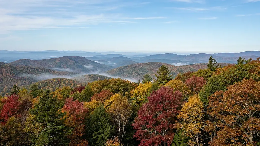
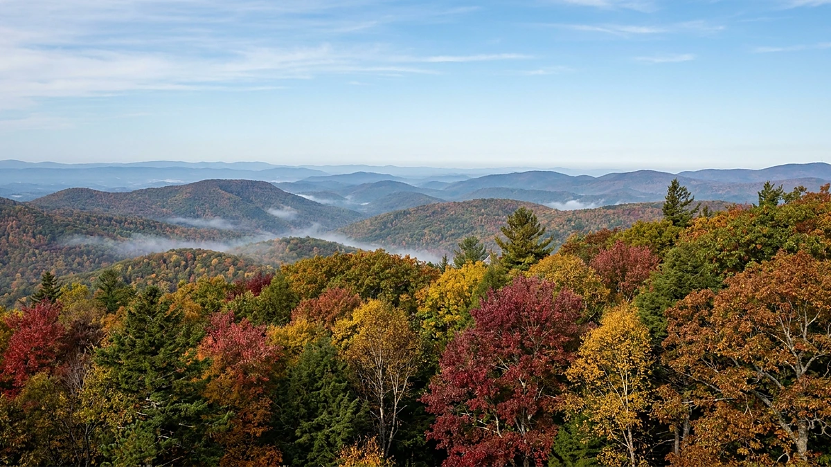
When Is Peak Fall Foliage in Dahlonega?
TL;DR · Quick answer
Peak fall color around Dahlonega is not a date. It is an elevation. The Georgia Forestry Commission reports leaf change separately above and below 3,000 feet, and in the region that contains Lumpkin County the high country reached 45 percent changed while the foothills sat at 15 percent on the same October day. The mountains above town turn first. Dahlonega itself finishes last, often into early November.
Want to wake up inside this every October?
Leaf season is the week most people decide they would rather live here than visit. See what is actually on the market in town, on the ridges, and along the river.
Search All Dahlonega Homes for Sale at Gold Peach RealtyOr talk to a local agent who has driven every one of these roads in October: (770) 283-1223
Every percentage, elevation and road name below was read from the agency that published it, and each one is attributed where it appears. The leaf-change numbers come from the Georgia Forestry Commission's own weekly Leaf Watch reports for the 2025 season, which is the most recent completed season at the time of writing. Several things you might expect are deliberately not printed here. There is no predicted peak date for any future year, because the Forestry Commission's own reports state that weather can shorten or lengthen the season. There is no drive time or mileage from Dahlonega to any overlook, because none was measured. There is no elevation figure for the town itself, because no agency page read for this article published one. There are no visitor counts, lodging occupancy figures or short-term-rental returns for leaf season, and no summary of Lumpkin County short-term-rental rules, because those would have to be invented rather than sourced. Color moves. Check the current conditions before you drive, using the two-minute method near the end of this article.
Table of Contents
- Why peak color has no fixed date
- What Georgia's own leaf reports actually show
- Why Dahlonega peaks last, not first
- Where to watch it, from the top of the ladder down
- How to check conditions before you drive
- The one weekend to plan around
- What leaf season means if you are buying here
- Frequently Asked Questions
Ask when the leaves peak in Dahlonega and almost every answer you find says the same thing: late October. Book the third weekend, drive up from Atlanta, done.
That answer is borrowed from the mountains, and Dahlonega is not in the mountains. It sits at the foot of them. The ridges that people photograph are a drive away and thousands of feet higher, and they run on a different schedule than the square does. Plenty of visitors have arrived on the "peak weekend," looked at a town still mostly green, and concluded they got a bad year.
They usually got a bad week. Georgia publishes enough data to fix that, and almost nobody writing about this town uses it. What follows is the season as the state's own foresters actually measure it, and what that means whether you are planning one drive or thinking about buying a house here.
Why peak color has no fixed date
The thing that starts the process is the most dependable clock there is. The US Forest Service puts it plainly:
As night length increases in the autumn, chlorophyll production in leaves slow down then is eventually destroyed.
US Forest Service, The Joy and Science of Fall ColorsChlorophyll is what makes a leaf green, and the Forest Service describes it as necessary for photosynthesis. The other pigments were there the whole time. Carotenoids produce the yellow, orange and brown. Anthocyanin is the compound the Forest Service says gives color to cranberries, red apples, concord grapes and cherries. Once the green production stops, what was already in the leaf becomes visible.
Night length is the reason the season is reliable. It repeats identically every year and no drought or warm spell moves it. That is why fall color always happens here, and roughly when you expect.
What is not fixed is how fast the display runs and how good it looks. The National Park Service ties the shutdown to falling temperature alongside shortening daylight, and notes the weather's effect on intensity: "When there is more rain, the colors pop even more! When there is a cool fall, the red maple leaves appear brighter as well." The Georgia Forestry Commission is blunter in its own reports, writing that weather can impact expected peak and can either shorten or lengthen the season.
So the season is a certainty and the calendar date is a forecast. Anyone printing a specific peak weekend for next year is guessing. The useful question is not when, it is where, and that has an answer with numbers behind it.
What Georgia's own leaf reports actually show
The Georgia Forestry Commission runs a program called Fall Leaf Watch. Through the season it publishes reports weekly, typically on Wednesdays, running from early October into early November. Each report breaks the state into Northwest, North Central and Northeast Georgia, and here is the part that matters: within each region it reports leaf change separately for elevations above and below 3,000 feet.
Dahlonega sits in the North Central region. The Commission's own reports settle that rather than leaving it to inference. Its October 8, 2025 report names Lumpkin County and the Hogpen Gap Overlook inside the North Central section, and its November 6, 2025 report names Dahlonega itself there.
This is the 2025 season for North Central Georgia, week by week, as the Commission reported it:
| Leaf Watch report | Above 3,000 ft | Below 3,000 ft | Gap |
|---|---|---|---|
| October 2, 2025 | 5% changed | 2% changed | 3 points |
| October 8, 2025 | 8% changed | 4% changed | 4 points |
| October 15, 2025 | 45% changed | 15% changed | 30 points |
| October 22, 2025 | 60% changed | 25% changed | 35 points |
| October 29, 2025 | 90% changed | 65% changed | 25 points |
| November 6, 2025 | — | — | — |
Source: Georgia Forestry Commission Fall Leaf Watch reports, North Central Georgia section, 2025 season. The November 6 report published narrative for this region instead of a percentage pair, so those cells are left blank rather than carrying the previous week's figures forward.
Look at October 15. The high country was 45 percent turned. The lower elevations of the same region, on the same day, reported by the same agency, sat at 15 percent. That is exactly three times as much color at altitude as there was down in the foothills.
One season could be a fluke, so here is the same measurement from the year before. On October 23, 2024, North Central Georgia reported 70 percent changed above 3,000 feet against 20 percent below it. The split is not a quirk of one autumn. It is the structure of the season here.
On a single mid-October day in 2025, one region of Georgia held both a 45 percent display and a 15 percent one. The difference between them was not luck or timing. It was about 3,000 feet of elevation, and it is drivable.
Why Dahlonega peaks last, not first
Read the table from the bottom up and the season stops looking like a weekend and starts looking like a wave that rolls downhill.
The Commission described it that way itself in October 2024, writing that peak conditions "will then be shifting into the mountain valleys, foothills, and elevations less than 3,000 feet during the first two weeks or so of November." In 2025 it told readers at the start of October to expect peak across the highest elevations of north Georgia "during the second half of October." By its October 29 report that year it had narrowed the next band, saying peak viewing could be anticipated within five to seven days across many locations in the 2,000 to 3,500 foot range.
Then the wave reaches the bottom. Here is the Forestry Commission on November 6, 2025, in the week the mountains had finished:
The 2025 fall foliage season across north-central Georgia is coming to a close. Higher elevations are now well past peak across the mountains, which is normal for early November.
Georgia Forestry Commission, Fall Leaf Watch report for November 6, 2025And in that same report, the Commission listed the best viewing locations left in the region as the foothills and lower elevations, naming Dahlonega first among them, alongside Dawsonville, Cumming, Gainesville and Jasper.
That is the state's own forestry agency putting Dahlonega on the best-viewing list in the week the high country was already spent. It is the clearest evidence available that this town is the closing act of leaf season rather than the opening one.
The practical consequence is worth spelling out. If you book the famous late-October weekend and never leave the square, you may be a week or two early for the trees around you. If you come in early November expecting to have missed everything, you may find the town at its best and the crowds gone. Both mistakes are common and both are avoidable.
What Dahlonega actually offers is not one peak weekend. It is a base at the bottom of a ladder whose top is close enough to drive before lunch. Go up early in the season, stay put late in it, and you can follow color for roughly a month without changing where you sleep.
Where to watch it, from the top of the ladder down
Every road and overlook in the upper half of this table is one the Georgia Forestry Commission named in its own Leaf Watch reports as a recommended viewing route. The lower half comes from our own guide to the best hiking trails and scenic spots near Dahlonega. No drive times appear because none were measured for this article.
| Rung on the ladder | Where to go | Roughly when it shows |
|---|---|---|
| The summit | Brasstown Bald, at 4,784 feet the highest point in Georgia, reached by the State Route 180 Spur | Earliest. Second half of October in a typical year |
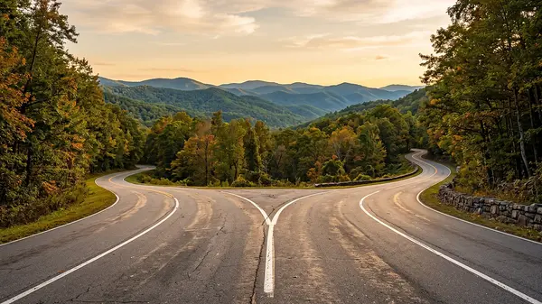
| High byways | Russell-Brasstown Scenic Byway; Richard B. Russell Scenic Highway; State Route 180 through Wolfpen Gap; State Route 180 in the Suches area | Earliest to mid-season |
| Gaps and overlooks | Hogpen Gap Overlook in Lumpkin County, named by the Forestry Commission in its North Central reports | Mid-season |
| Ridge trails | Appalachian Trail from Neels Gap toward Blood Mountain, a 4.5 mile round trip; Preacher's Rock on Big Cedar Mountain, 1.9 miles round trip | Mid-season |
| Waterfalls and coves | Amicalola Falls, at 729 feet Georgia's tallest waterfall, with its 604-step staircase; Raven Cliff Falls, a 5 mile round trip | Mid to late season |
| Town and river | The historic square; Yahoola Creek Park; Frogtown Creek | Latest. Often into the first half of November |
Species matter as much as altitude, and they do not turn together. The Forestry Commission's reports repeatedly note the understory going first, describing dogwood, sourwood, sumac and occasional maples showing strong color while the canopy above them is still green. At the other end it flags oaks as among the last, noting in one late-October report that all species were within the peak period "with oaks being in the early stage of peak."
Across its 2025 reports the Commission named sourwood, blackgum, dogwood, red maple, oak, hickory, yellow-poplar, sumac, sweetgum, sassafras, elm, birch, black walnut, eastern redbud and sycamore as contributors to Georgia's display. That mix is why a hillside here rarely turns all at once, and why a drive that looked finished last week can still be worth repeating.
If you would rather build a full day around it, our roundup of the top attractions in Dahlonega covers the mines, museums and vineyards that fill the hours between drives, and our seasonal guide to Dahlonega sets autumn in the context of the rest of the year.
How to check conditions before you drive
Here is a trap worth knowing about. Georgia has two different programs both called Leaf Watch, run by two different agencies, and they do two different jobs. Travel articles conflate them constantly.
| Georgia Forestry Commission | Georgia State Parks | |
|---|---|---|
| Program | Fall Leaf Watch | Leaf Watch |
| What it gives you | Weekly condition reports with percent of leaf change, split by region and by elevation above or below 3,000 feet | A travel guide naming parks, trails, overlooks, cabins and campsites |
| Use it to answer | Has it turned yet, and at what height | Where should I stay and walk once it has |
| Published | Weekly through the season, typically Wednesdays | Refreshed for each season |
The State Parks guide is genuinely useful for the second question. Its list of top parks for color includes Amicalola Falls at Dawsonville, the closest of them to Dahlonega, along with Vogel at Blairsville, Unicoi and Smithgall Woods at Helen, Black Rock Mountain at Clayton and Tallulah Gorge. But it is not a conditions report, and treating it as one is how people end up driving to a green mountain.
1. Read this week's Forestry Commission report first
Find the current Fall Leaf Watch report from the Georgia Forestry Commission and go straight to the North Central Georgia section, which is the one covering Lumpkin County and Dahlonega. Note both numbers, above and below 3,000 feet, not just the headline.
2. Pick your elevation from the gap between them
If the high figure is far ahead of the low one, drive up and take a byway or a gap. If the two numbers have converged and the report says the high country is past peak, stay low and spend the day in and around town.
3. Check the report's own recommended routes
Each report names specific roads for each region that week. Those recommendations move through the season, so use the current one rather than a road you read about in an old article.
4. Then use the State Parks guide for logistics
Once you know which elevation band is working, use the Georgia State Parks Leaf Watch guide to choose the park, trail, overlook or cabin. Confirm the current year's edition rather than an archived one.
5. Add a weather check for the drive itself
Conditions at 4,000 feet are not conditions in town. Ridge roads can sit in cloud on a clear morning down below, and an overlook in fog shows you nothing regardless of how the trees are doing.
The one weekend to plan around
One date does hold still, and it lands inside the color window. Gold Rush Days is described by the Dahlonega-Lumpkin County Visitors Bureau as Dahlonega's largest festival of the year, and the Bureau publishes its timing as a rule rather than an announcement: held annually on the third full weekend in October.
Run that rule against 2026. October begins on a Thursday, so the full Saturday-to-Sunday weekends are the 3rd and 4th, the 10th and 11th, the 17th and 18th, and the 24th and 25th. The third of those is October 17 and 18, which is what the Visitors Bureau publishes.
Set that beside the leaf table and the overlap is obvious. The third full weekend of October is the same stretch when the high country is climbing toward or sitting at peak, which is a large part of why the festival is as busy as it is. If you want the mountains at their best and a quiet town to come back to, this is the weekend to work around rather than through. If you want the festival, take it, and understand that the trees on the square will probably still be catching up.
We keep a separate guide to Gold Rush Days, with parking and logistics, so this article does not repeat it. Confirm the current year's dates with the organizer before booking anything around them.
What leaf season means if you are buying here
Autumn is when this town does most of its recruiting. People come up for a drive, eat on the square, and start looking in windows at listing sheets. If that is how you got here, a few things are worth knowing before the season does your thinking for you.
The view you are buying changes twice a year. This is the single most overlooked item on a mountain lot, and it cuts both ways. A ridge or slope property toured in late autumn or winter, with the canopy down, can show a long layered view that closes almost completely once the leaves return in spring. The reverse is just as common. A house toured in high summer, walled in by green, may open onto a serious view every November. Neither version is dishonest. They are the same property in two different states, and photographs taken in one season will not tell you about the other.
If a view is part of why you want a property, ask what it looks like with the canopy in the opposite state, and ask which season the listing photographs were taken in. On a wooded lot the honest answer is often that the winter view and the summer view are two different houses.
1. Establish which way the trees are working
Walk the lot and note whether the view is framed by deciduous canopy or by evergreen. Deciduous cover opens in winter and closes in summer. Pine and hemlock hold their screen year round, so what you see is what you get.
2. Find the property line before you fall for the view
A view over a neighbor's woods lasts exactly as long as the neighbor keeps the woods. A view over your own acreage, or over protected land, is a different asset. Confirm what you actually own and what borders it.
3. Drive the access road, not just the driveway
Ridge and cove properties are reached by roads that can be steep, narrow, gravel or shared. Drive the whole route in and out. Ask who maintains it, and whether that maintenance is a recorded obligation or a neighborly habit.
4. Come back on an ordinary week
Touring in the busiest fortnight of the year distorts everything. Traffic, parking and noise all read differently in mid-October than they do in February. If you can, see the street twice.
5. Ask about rental use in writing, at the source
If part of the appeal is renting the place out during leaf season, do not rely on what a listing or an article says is allowed. Short-term rental rules differ between the city and the unincorporated county and they change. Get the current rule from the jurisdiction that governs the address, and check any homeowners association covenants separately.
Where you land on the elevation ladder shapes what you are buying, too. Higher and more remote generally means earlier color, longer drives, harder winter access and a smaller pool of comparable sales. Closer to town means later color, easier access year round, and a market with more depth to it. Neither is better. They are different products, and leaf season makes the high one look more appealing than a February visit would.
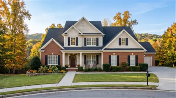
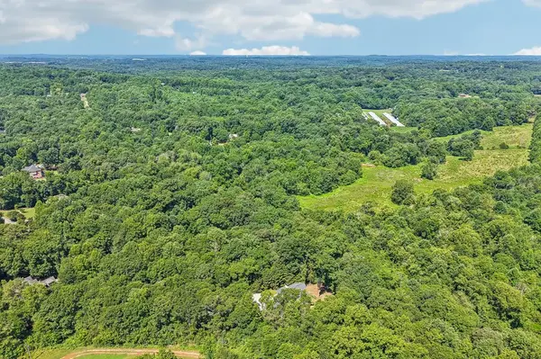
If you are working out which rung suits you, browsing helps more than reading. Start with every home currently for sale in Dahlonega, then narrow by what you are actually after: cabins in and around Dahlonega if you want something already built to sit in the woods, or land and acreage in Dahlonega if you would rather choose your own elevation and build to the view. Our Dahlonega market report covers what homes here are trading at, which is the part no scenic drive will tell you.
See it in the season you would actually live in
Anyone can love this place in the third week of October. The useful conversation is about what a property is like in February, what the view does when the leaves come back, and what it is worth either way. That is a local conversation, and we are happy to have it before you make an offer.
Browse Dahlonega Homes for Sale with Gold Peach RealtyCall (770) 283-1223 or contact Gold Peach Realty. Selling instead? Start with a home valuation and seller consultation.
Frequently Asked Questions
When is peak fall foliage in Dahlonega, GA?
There is no fixed date, and the honest answer depends on elevation. In the Georgia Forestry Commission's North Central region, which contains Lumpkin County and Dahlonega, the highest elevations typically peak in the second half of October, while the foothills and lower elevations around Dahlonega itself run later, often into the first half of November. In its November 6, 2025 report the Commission named Dahlonega among the best remaining viewing locations in the region, in the same week it described the higher elevations as well past peak.
Does Dahlonega peak before or after the north Georgia mountains?
After. Dahlonega sits at the foot of the mountains rather than in them, and color moves downhill through the season. On October 15, 2025 the Forestry Commission reported 45 percent leaf change above 3,000 feet in this region against 15 percent below it, three times as much color at altitude on the same day.
Is late October the best time to visit Dahlonega for leaves?
It is the best time to visit Dahlonega as a base for driving up into the mountains, because the high country is at or near peak then. It is often too early for the trees in town. If you want color in Dahlonega itself, early November is frequently better, and it is quieter.
Where can I check current fall color conditions in north Georgia?
The Georgia Forestry Commission publishes Fall Leaf Watch reports weekly through the season, typically on Wednesdays from early October into early November, with percent of leaf change broken out by region and by elevation above and below 3,000 feet. Read the North Central Georgia section for the Dahlonega area.
What is the difference between the two Georgia Leaf Watch programs?
They are run by different agencies and do different jobs. The Georgia Forestry Commission's Fall Leaf Watch gives weekly condition reports with leaf-change percentages by elevation. Georgia State Parks publishes a separate guide, also called Leaf Watch, which is a travel planner naming parks, trails, overlooks, cabins and campsites. Use the first to decide whether to go and how high, and the second to decide where to stay and walk.
What are the best fall foliage drives near Dahlonega?
The Georgia Forestry Commission has named the Russell-Brasstown Scenic Byway, the Richard B. Russell Scenic Highway, State Route 180 through Wolfpen Gap, State Route 180 in the Suches area, the State Route 180 Spur up to Brasstown Bald, and State Route 17/75 south of Hiawassee among its recommended viewing routes. It has also specifically named the Hogpen Gap Overlook in Lumpkin County. The routes it recommends shift as the season moves, so check the current week's report.
How high is Brasstown Bald and why does it matter for leaf season?
Brasstown Bald is 4,784 feet, the highest point in Georgia, according to the Georgia Forestry Commission. It matters because elevation is what drives timing here. The summit is among the first places in the state to turn, which makes it the right destination early in the season and the wrong one once the wave has moved downhill.
Why do leaves change color in the first place?
The US Forest Service explains that as night length increases in autumn, chlorophyll production slows and is eventually destroyed. Chlorophyll is what makes leaves green and is necessary for photosynthesis. Once it stops being produced, pigments already present become visible: carotenoids produce yellow, orange and brown, and anthocyanin produces the reds and purples.
Does a dry summer or a warm autumn ruin the color?
Weather changes the display without cancelling it, because the trigger is night length rather than temperature. The Georgia Forestry Commission states that weather can impact expected peak and can either shorten or lengthen the season. The National Park Service notes that more rain makes colors pop more and that a cool fall makes red maple leaves appear brighter. This article does not predict any given year's quality, because that would be a guess.
Which trees turn first and which turn last around Dahlonega?
The understory tends to go first. Forestry Commission reports repeatedly describe dogwood, sourwood, sumac and occasional maples showing strong color while the canopy is still green. Oaks are among the last, with one late-October report placing all species in the peak period but oaks only in the early stage of it.
Does Gold Rush Days fall during peak foliage?
It falls inside the window when the higher elevations are at or approaching peak. The Dahlonega-Lumpkin County Visitors Bureau publishes Gold Rush Days as being held annually on the third full weekend in October, which places it in 2026 on October 17 and 18. Expect the mountains to be well along and the trees in town to be earlier in their turn. Confirm the current year's dates with the organizer.
Should I buy a home in Dahlonega after seeing it in the fall?
See it in another season first if you can, particularly if the view is part of the appeal. A wooded lot toured with the canopy down can show a long view that closes when leaves return, and a property walled in by summer green may open onto a real view in November. Ask which season the listing photographs were taken in, confirm what you own versus what you are borrowing from a neighbor's woods, and drive the access road in full.
Can I rent my Dahlonega property out during leaf season?
Possibly, but confirm it at the source before you count on it. Short-term rental rules differ between the City of Dahlonega and unincorporated Lumpkin County, and homeowners association covenants can restrict rentals separately from any local ordinance. This article does not summarize those rules, because they change and because getting them wrong is expensive. Ask the jurisdiction that governs the specific address.
Is there anywhere to see color around Dahlonega without a long drive?
Yes, and it is the part of the season Dahlonega actually owns. The historic square, Yahoola Creek Park and Frogtown Creek all sit at the low end of the elevation ladder, which means they hold color after the byways have finished. Amicalola Falls, Georgia's tallest waterfall at 729 feet with its 604-step staircase, is the nearest of the state parks that Georgia State Parks lists among its top spots for color.
Important: All information in this article is believed to be reliable but is not guaranteed and is subject to change without notice. Fall color timing, leaf-change percentages and recommended viewing routes are published by the Georgia Forestry Commission and Georgia State Parks, not by Gold Peach Realty, and every figure and route named here was read from those agencies' own published reports at the time of writing. Foliage conditions vary year to year with weather and cannot be predicted for a future season. Event dates are set by their organizers; confirm the current year directly with them. Short-term rental rules, zoning, road maintenance obligations and homeowners association covenants vary by address and change over time, and must be verified with the governing jurisdiction and the relevant association rather than relied on from this article. Nothing here constitutes legal, financial, tax, or investment advice. Gold Peach Realty is a licensed Georgia real estate brokerage, License 381292. Equal Housing Opportunity.
Last updated:
Categories
- All Blogs (664)
- Achasta Golf Community (78)
- Cleveland, GA (47)
- Dacula, GA (43)
- Dahlonega GA (166)
- Dawsonville, GA (46)
- Forsyth County, GA (2)
- Gainesville, GA (47)
- Gold Peach Realty (36)
- Helen, GA (44)
- Home Buying Tips (42)
- Home Décor And Interior Design (7)
- Home Improvement Tips (15)
- Home Selling Tips (29)
- Homes For Sale (56)
- Lake Lanier, GA (72)
- Land & Acreage (2)
- Local Events (13)
- Local Guides (27)
- Luxury Real Estate (3)
- Market Reports (17)
- Mortgage And Finance Tips (27)
- New Construction (2)
- North Georgia (47)
- Relocating To North Georgia (19)
Recent Posts
GET MORE INFORMATION