Dahlonega Creekfront Homes: The Riverfront Buyer's Guide
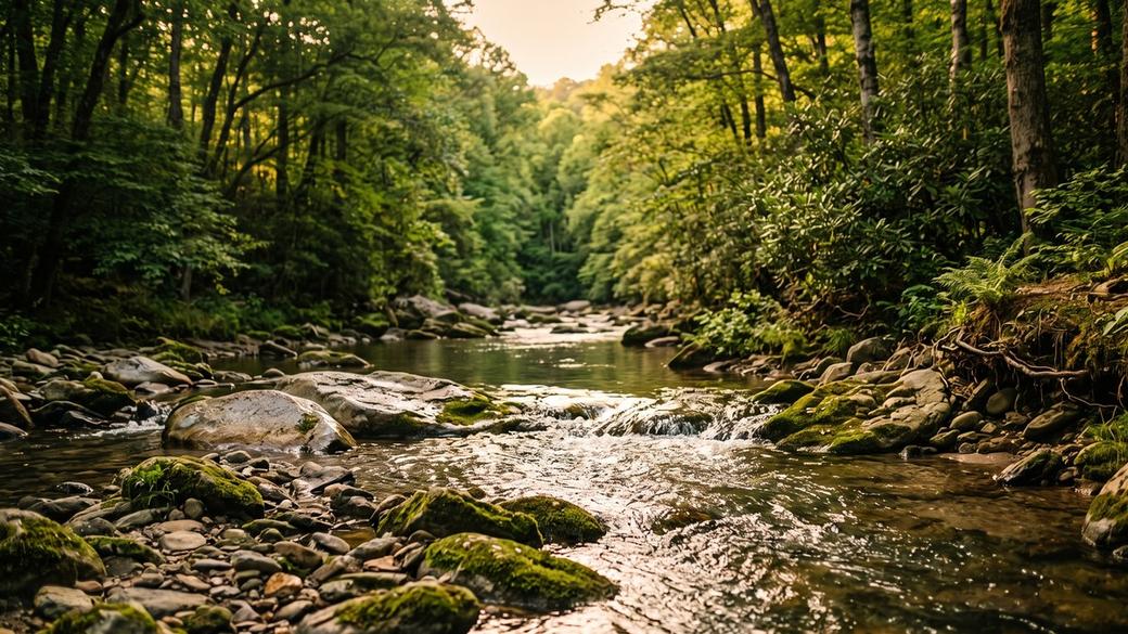
Dahlonega Creekfront Homes: The Riverfront Buyer's Guide
TL;DR: Quick answer
Creekfront and riverfront homes in Dahlonega are governed less by the listing photos than by three rules: Georgia's statutory 25-foot stream buffer under O.C.G.A. § 12-7-6, which widens to 50 feet on designated trout streams; Public Health septic rules that push a drainfield 50 feet back from the water; and federal flood insurance rules if the structure is mapped in a Special Flood Hazard Area. Verify all three before you write an offer.
Looking at creekfront or riverfront property around Dahlonega?
Water frontage changes what you can build, where the septic can go and how the property insures. Gold Peach Realty walks the parcel with you before you write the offer, not after. Call (770) 283-1223.
Search All Dahlonega Homes for Sale →Table of Contents
- What counts as creekfront or riverfront in Dahlonega
- The buffer rule that decides what you can build
- Which Dahlonega waters are classified trout streams
- Flood zones, insurance and elevation
- Septic, wells and the setback most buyers miss
- Ponds, dams and impoundments
- What to verify before you write an offer
- Frequently Asked Questions
Lumpkin County carries fifteen separate trout-water designations under Georgia's water use rules, and that single fact reshapes almost every creekfront and riverfront purchase in the Dahlonega area. Under Georgia's Erosion and Sedimentation Act, a buffer that is 25 feet on an ordinary stream becomes 50 feet on a designated one, and the line is drawn from where flowing water has stripped the vegetation, not from where the water happens to sit the afternoon you tour the property.
This guide covers what actually constrains a Dahlonega water-frontage purchase: the buffer, the trout classifications, the flood rules, and the septic setbacks that decide whether a lot is buildable at all. Every rule below is quoted from its governing statute or regulation, and where a number could not be verified from a primary source, we say so instead of estimating it. When you are ready to see what is available, search all Dahlonega homes for sale at Gold Peach Realty or call (770) 283-1223. If the river corridor specifically is what you are after, start with Chestatee River homes for sale in Dahlonega.
What counts as creekfront or riverfront in Dahlonega
Buyers searching for Dahlonega creekfront homes are usually describing one of three very different things: a home whose deeded boundary crosses or touches a watercourse, a home with a view of water it does not own, or a home with deeded access to water elsewhere in a subdivision. Only the first gives you frontage, and only frontage brings the regulatory picture described here.
The named waters around Dahlonega range from the Chestatee and Etowah rivers down to small tributaries like Cavender Creek, Camp Creek, Clay Creek and Mooney Branch. Georgia's buffer law does not distinguish between a river and a creek by name. It asks two questions: are these state waters, and are they classified as trout streams?
A listing that says “creek on property” may mean the creek forms the rear boundary, runs through the middle of the parcel, or runs just outside it. These three situations produce very different buildable areas. Ask for the survey with the watercourse drawn, and if there is not one, budget for it. If you are weighing raw land instead of an existing house, our guide to buying land and acreage in Dahlonega covers the survey and access questions in more depth.
The buffer rule that decides what you can build
The Georgia Erosion and Sedimentation Act is the controlling law, and its language is unusually specific about measurement. Under O.C.G.A. § 12-7-6(b)(15), the statute provides:
“There is established a 25 foot buffer along the banks of all state waters, as measured horizontally from the point where vegetation has been wrested by normal stream flow or wave action.”
O.C.G.A. § 12-7-6(b)(15)
Two things in that sentence matter to a buyer. The buffer runs from the wrested vegetation line, which is the point scoured by normal flow, which is often well back from a low summer water level. And the measurement is horizontal, so on a steep bank the buffer covers more ground than a tape laid along the slope would suggest.
For trout streams, subsection (b)(16) doubles it:
“There is established a 50 foot buffer, as measured horizontally from the point where vegetation has been wrested by normal stream flow or wave action, along the banks of any state waters classified as ‘trout streams’.”
O.C.G.A. § 12-7-6(b)(16)
Buffer widths: O.C.G.A. § 12-7-6(b)(15)–(16). Drainfield setbacks: Georgia Department of Public Health on-site sewage rules, Ga. Comp. R. & Regs. 511-3-1-.07. Figures are statewide minimums, not parcel-specific determinations.
There are exceptions written into the statute, including variances granted by the EPD director, drainage structure construction, and ephemeral streams. There is also a narrower one worth knowing: a trout stream with an average annual flow of 25 gallons per minute or less may carry a reduced 25-foot buffer or be piped at the landowner's discretion. That is a measured flow rate, not an impression formed while standing on the bank.
Significant land disturbance inside the buffer requires a variance from the Georgia Environmental Protection Division. Thinning or trimming is treated differently from clearing, provided water quality and aquatic habitat stay protected and enough natural canopy remains to shade the streambed. A previous owner's unpermitted clearing can become your enforcement problem after closing.
Which Dahlonega waters are classified trout streams
This is where a lot of otherwise careful research goes wrong. Georgia maintains two different trout lists, and they are not interchangeable. The Department of Natural Resources fishing regulation sets seasons and lists waters open for trout fishing. The Environmental Protection Division water use classification at Ga. Comp. R. & Regs. 391-3-6-.03 is the one the buffer statute keys off. Their Lumpkin County boundaries genuinely differ, because the fishing rule and the EPD rule name different roads and bridges as cut-off points, so reading the wrong one can hand you the wrong buffer width.
The list below is the EPD water use classification for Lumpkin County, transcribed from the EPD county designations document compiled in March 2014. EPD defines the two tiers this way:
“Streams designated as Primary Trout Waters are waters supporting a self-sustaining population of Rainbow, Brown or Brook Trout. Streams designated as Secondary Trout Streams are those with no evidence of natural trout reproduction, but are capable of supporting trout throughout the year.”
Ga. Comp. R. & Regs. 391-3-6-.03(15)
Lumpkin County — Primary Trout Waters
- Amicalola Creek watershed.
- Camp Creek watershed.
- Cane Creek watershed upstream from Cane Creek Falls.
- Cavender Creek watershed.
- Chestatee River watershed upstream from Lumpkin County Road 52-S976 (Lumpkin County Road 190).
- Clay Creek watershed.
- Etowah River watershed upstream from the Georgia Hwy. 52 Bridge.
- Hurricane Creek watershed upstream from Lumpkin County Road 202.
- Mooney Branch watershed.
- Tobacco Pouch Branch watershed.
Lumpkin County — Secondary Trout Waters
- Cane Creek watershed upstream from Georgia Hwy. 52 Bridge to Cane Creek Falls.
- Chestatee River watershed upstream from the mouth of Tesnatee Creek to Lumpkin County Road 52-S976 (Lumpkin County Road 190).
- Etowah River watershed upstream from Castleberry Bridge to Georgia Hwy. 52 except those classified as primary above.
- Shoal Creek watershed.
- Yahoola Creek watershed upstream from Georgia Hwy. 52.
Almost every entry above carries a geographic cut-off. The Chestatee River is Primary upstream from Lumpkin County Road 52-S976 and Secondary from the mouth of Tesnatee Creek up to that same road. A parcel can sit a short distance downstream of a boundary and fall outside the designation entirely. This compilation is dated March 2014; designations can be revised, so confirm the current classification for your specific parcel with EPD rather than relying on this or any other published list.
Flood zones, insurance and elevation
Water frontage and flood risk are related but not identical. A Special Flood Hazard Area is the area with at least a 1% annual chance of flooding. That is the base flood, often called the 100-year flood, and it describes a probability rather than a schedule. A parcel can have significant creek frontage and sit largely outside the mapped area, or have modest frontage and sit substantially inside it. Topography decides, not frontage length.
If the structure is inside the mapped area and you are financing, the requirement is federal and not negotiable with the lender. 42 U.S.C. § 4012a(b)(1) directs regulated lending institutions:
“not to make, increase, extend, or renew any loan secured by improved real estate or a mobile home located or to be located in an area that has been identified by the Administrator as an area having special flood hazards … unless the building or mobile home and any personal property securing such loan is covered for the term of the loan by flood insurance in an amount at least equal to the outstanding principal balance of the loan or the maximum limit of coverage made available under the Act with respect to the particular type of property, whichever is less.”
42 U.S.C. § 4012a(b)(1)
Pull the parcel yourself on the FEMA Flood Map Service Center rather than trusting a listing remark. If any part of the structure is mapped in, ask for an elevation certificate. That document, not the zone label alone, is what drives the rating.
Many Georgia counties require new construction in a flood hazard area to sit some margin above base flood elevation, a cushion called freeboard. We could not retrieve Lumpkin County's adopted flood damage prevention ordinance from a primary source on the date this article was written, because the county's hosted code returned an access error, so we are not publishing a Lumpkin freeboard figure. Other counties' numbers are not evidence of Lumpkin's. Confirm the current local requirement directly with Lumpkin County Planning and Zoning before designing anything.
Septic, wells and the setback most buyers miss
Most creekfront parcels around Dahlonega are on septic rather than sewer, and the septic rules quietly disqualify more lots than the buffer does. The reason is that buyers who research this at all tend to find the septic tank number and stop there.
Under the Georgia Department of Public Health on-site sewage rules, a septic tank may not be installed less than 25 feet from lakes, ponds, streams, water courses or impoundments. But the absorption field (the drainfield, which needs far more area than the tank) must be not less than 50 feet from the normal water level of impoundments, tributaries, streams and bodies of water. That is double, and it applies to the largest component.
| Component | From streams & water bodies | From wells, springs, sinkholes | Source |
|---|---|---|---|
| Septic tank | 25 ft minimum | 50 ft minimum | Ga. Comp. R. & Regs. 511-3-1-.05 |
| Absorption field (drainfield) | 50 ft minimum | 100 ft minimum | Ga. Comp. R. & Regs. 511-3-1-.07 |
| Stream buffer (all state waters) | 25 ft | — | O.C.G.A. § 12-7-6(b)(15) |
| Stream buffer (trout streams) | 50 ft | — | O.C.G.A. § 12-7-6(b)(16) |
On a narrow lot with a creek along one boundary and a well on the other, these setbacks overlap. The buffer takes the creek side, the Public Health rules require the drainfield to sit 50 feet from the water and 100 feet from the well, and what remains may not be large enough or well-drained enough to permit. A soil and site evaluation through the county environmental health office answers this before you are committed, and it is inexpensive relative to the risk. Full setback details are in the Georgia DPH on-site sewage rules.
On water-frontage parcels we walk the buffer line and the proposed drainfield area before our buyer writes anything, because those two constraints decide whether a lot is a homesite or a very attractive campsite. The survey and the soil evaluation cost a fraction of what it costs to discover the answer after closing.
Gold Peach Realty — Dahlonega, Georgia
Ponds, dams and impoundments
A pond is a common reason buyers want a creek in the first place, and on designated trout water it is the plan most likely to be refused. The EPD water use rules are direct about it: no impoundment may be constructed on Primary Trout Waters except on streams with drainage basins less than 50 acres upstream of the impoundment, and those must be approved by the Division. An impoundment on Secondary Trout Waters requires Division approval as well.
The rules also cap thermal change: no elevation of natural stream temperature is permitted for Primary Trout Waters, and 2 degrees Fahrenheit or less for Secondary. Since impounding water in a sunlit pond tends to warm it, this constraint and the impoundment rule reinforce each other. If a pond is central to why you want the property, resolve it with EPD during due diligence rather than after.
What to verify before you write an offer
-
Get the survey with the water drawnConfirm whether the watercourse is inside the boundary, forms the boundary, or sits outside it, and have the buffer line shown.
-
Confirm the EPD classification for that reachCheck the water use classification for your specific parcel, reading the geographic cut-off and not just the stream name. This sets your statutory buffer under O.C.G.A. § 12-7-6 at 25 or 50 feet.
-
Pull the FEMA panel for the parcelUse the Flood Map Service Center directly. If the structure is mapped in, request an elevation certificate.
-
Order or review the soil and site evaluationUnder the Public Health on-site sewage rules, confirm a compliant drainfield location exists at 50 feet from water and 100 feet from any well, with adequate area and drainage.
-
Ask Lumpkin County for its floodplain requirements in writingLocal construction requirements sit on top of state and federal rules and can be stricter.
-
Ask about existing variances and prior disturbanceAn unpermitted clearing or an existing buffer variance both transfer with the property as facts you inherit.
Ready to see what is actually on the market?
Search all Dahlonega homes for sale at Gold Peach Realty, or call (770) 283-1223 and we will pull every listing with real water frontage on the creek or river you have in mind.
Search All Dahlonega Homes for Sale →Frequently Asked Questions
What is the difference between creekfront and riverfront property in Dahlonega?
The distinction is descriptive rather than legal. Around Dahlonega, “riverfront” usually means frontage on the Chestatee or Etowah, and “creekfront” means frontage on a smaller named watercourse such as Yahoola, Cane, Cavender or Camp Creek. Georgia's buffer law does not care what the water is called. What matters is whether it is state waters and whether it carries a trout classification, because under O.C.G.A. § 12-7-6 that is what sets your buffer at 25 or 50 feet.
How close to the creek can I actually build?
Under O.C.G.A. § 12-7-6, Georgia establishes a 25-foot buffer along the banks of all state waters, and 50 feet where the water is classified as a trout stream. The buffer is measured horizontally from the point where vegetation has been wrested by normal stream flow, not from the water's edge on the day you walk it. County zoning setbacks, floodplain rules and septic setbacks apply on top of that, so the buildable envelope is whichever constraint is strictest.
Is the Chestatee River a trout stream?
Parts of it are, and the boundary matters. In the Georgia EPD county designations compiled in March 2014, the Chestatee River watershed upstream from Lumpkin County Road 52-S976 (Lumpkin County Road 190) is listed as Primary Trout Water, and the stretch upstream from the mouth of Tesnatee Creek to that same road is listed as Secondary. A parcel can sit just outside a designated reach. Confirm the classification for your specific parcel with EPD before assuming a buffer width.
Does a trout designation mean I cannot build a pond?
It restricts it significantly. Under the EPD water use rules, no impoundment may be constructed on Primary Trout Waters except on streams with drainage basins less than 50 acres upstream of the impoundment, and even those must be approved by the Division. An impoundment on Secondary Trout Waters requires Division approval. If a pond is part of why you want the land, resolve this before you go under contract.
What is the difference between Primary and Secondary trout waters?
EPD defines Primary Trout Waters as waters supporting a self-sustaining population of Rainbow, Brown or Brook Trout, and Secondary Trout Streams as those with no evidence of natural trout reproduction but capable of supporting trout throughout the year. Both carry the 50-foot buffer. The practical difference shows up in impoundment rules and in the allowed temperature change: no elevation of natural stream temperature for Primary, and 2 degrees Fahrenheit or less for Secondary.
Can I clear the brush along my own creek bank?
Not freely. A landowner may not cause significant land disturbance inside the buffer without a variance from the Georgia Environmental Protection Division. Trimming and thinning are treated differently from clearing, and the governing condition is that water quality and aquatic habitat stay protected with enough natural canopy left to shade the streambed. Ask EPD before you run a machine anywhere near the bank.
Do I have to buy flood insurance on a Dahlonega creekfront home?
If the structure sits in a Special Flood Hazard Area and you are financing with a federally regulated lender, yes. Federal law bars such a lender from making, increasing, extending or renewing that loan unless the building is covered for the term of the loan, in an amount at least equal to the outstanding principal balance or the maximum available NFIP limit, whichever is less. If the structure sits outside the mapped area, coverage is optional but still worth pricing.
How do I find out if a specific property is in a flood zone?
Pull the parcel yourself on the FEMA Flood Map Service Center rather than relying on a listing remark or a seller's recollection. Map panels are revised, and a home built decades ago may sit in a zone that did not exist when it was permitted. If any part of the structure is mapped in, ask for an elevation certificate, which is what actually drives the rating.
Where can the septic system go on a creekfront lot?
This is the constraint that quietly kills more creekfront deals than the buffer does. Under the Georgia Department of Public Health rules, a septic tank may not be installed less than 25 feet from lakes, ponds, streams, water courses or impoundments, and the absorption field must be not less than 50 feet from the normal water level of impoundments, tributaries, streams and bodies of water. The drainfield number is the binding one, and it is double the tank number.
What if the lot also has a well?
The setbacks stack against each other. Under the same Public Health on-site sewage rules, an absorption field must be not less than 100 feet from wells, springs or sinkholes, and a septic tank not less than 50 feet from the same. On a narrow lot with water on one side and a well on the other, the well setback, the drainfield setback and the stream buffer can overlap until there is no compliant location left. A soil and site evaluation answers this before you are committed.
Does a creek on the property give me the right to use the water?
Georgia follows a riparian system for surface water, which broadly means an owner whose land adjoins a watercourse has rights to reasonable use of it, subject to the rights of other riparian owners and to state permitting for larger withdrawals. It is not an unlimited right, and it is not a right to alter the channel. Treat any plan that involves diverting, damming or withdrawing meaningful volume as a question for EPD and a Georgia attorney, not for a listing agent.
Are there fewer creekfront homes than buyers want in Dahlonega?
Water frontage is inherently a limited feature, and in Lumpkin County a large share of the designated watersheds sits in terrain that is steep, wooded or already in conservation. We are not publishing an inventory count or a price premium here because we do not have a verified, non-circular source for either. If you want current numbers, ask us to pull live MLS data for the specific water body you are targeting.
Does the buffer apply if the creek only runs part of the year?
The statute's exceptions include ephemeral streams, so a channel that flows only in direct response to rainfall is treated differently from a perennial or intermittent stream. Whether a given channel is ephemeral is a technical determination, not a judgment call you or the seller should be making. If the answer changes what you can build, get it in writing from EPD or a qualified consultant.
Is a smaller trout stream still a 50-foot buffer?
Not always. The statute allows trout streams with an average annual flow of 25 gallons per minute or less to carry a reduced 25-foot buffer, or to be piped, at the landowner's discretion. That is a flow measurement, not an eyeball estimate, and it is worth establishing formally if the difference between 25 and 50 feet decides whether your house fits.
What should I ask for before making an offer on creekfront property?
Ask for the survey with the water feature and buffer line shown, the FEMA panel for the parcel, the septic permit and soil evaluation or a new one, the EPD classification for the watercourse, any existing buffer variance, and the county's floodplain requirements in writing. If a seller cannot produce these, that is not a reason to walk, but it is a reason to make your offer contingent on getting them.
Thinking about selling a creekfront or riverfront property instead? Water frontage is a genuine differentiator when it is documented, and buyers increasingly ask these questions up front. Request a home valuation from Gold Peach Realty and we will position the buffer, septic and flood details as selling points rather than surprises.
About the sources in this article: the buffer widths, trout stream designations, septic setbacks and flood insurance requirements above are quoted from the cited Georgia statutes and regulations and from federal law, each linked at the point of use. The EPD trout designation list is the compilation dated March 2014 and designations may since have been revised. This article deliberately publishes no price, price premium, inventory count or market statistic for creekfront property, because no verified non-circular source for those figures was available; ask us to pull current MLS data instead. No figure here is specific to any individual parcel.
Important: All information in this article is believed to be reliable but is not guaranteed and is subject to change without notice. Property data including buffer applicability, flood zone, septic capacity, square footage, lot dimensions, school district boundaries, and market statistics should be independently verified by the buyer, seller, or their licensed representative before any real estate decision. This article is provided for informational purposes and does not constitute legal, financial, tax, engineering, or investment advice. Gold Peach Realty is a licensed Georgia real estate brokerage. Equal Housing Opportunity.
Gold Peach Realty · Dahlonega, GA · (770) 283-1223 · [email protected]
Last updated:
Categories
- All Blogs (664)
- Achasta Golf Community (78)
- Cleveland, GA (47)
- Dacula, GA (43)
- Dahlonega GA (166)
- Dawsonville, GA (46)
- Forsyth County, GA (2)
- Gainesville, GA (47)
- Gold Peach Realty (36)
- Helen, GA (44)
- Home Buying Tips (42)
- Home Décor And Interior Design (7)
- Home Improvement Tips (15)
- Home Selling Tips (29)
- Homes For Sale (56)
- Lake Lanier, GA (72)
- Land & Acreage (2)
- Local Events (13)
- Local Guides (27)
- Luxury Real Estate (3)
- Market Reports (17)
- Mortgage And Finance Tips (27)
- New Construction (2)
- North Georgia (47)
- Relocating To North Georgia (19)
Recent Posts


GET MORE INFORMATION